
REALITY MODEL
A LiDAR-Based Site Model for Every Phase of Development.
From raw land to final construction, the Reality Model delivers survey-grade site intelligence — accurate, accessible, and built around the way your team works.
What Is a Reality Model?
A Reality Model is a comprehensive, LiDAR-based digital site model that captures existing conditions across every phase of a development project — from raw undeveloped land through active construction and final completion. It is not a rendering or a concept model; it is a verified, data-rich record of your site as it actually exists.
Each Reality Model is produced using drone-mounted LiDAR sensors and high-resolution aerial camera systems operated by FDC Reality's in-house FAA-licensed pilots. Survey-grade horizontal and vertical site control — established by licensed professional surveyors — grounds every dataset to real-world coordinates. The result is a model you can measure, analyze, and rely on.
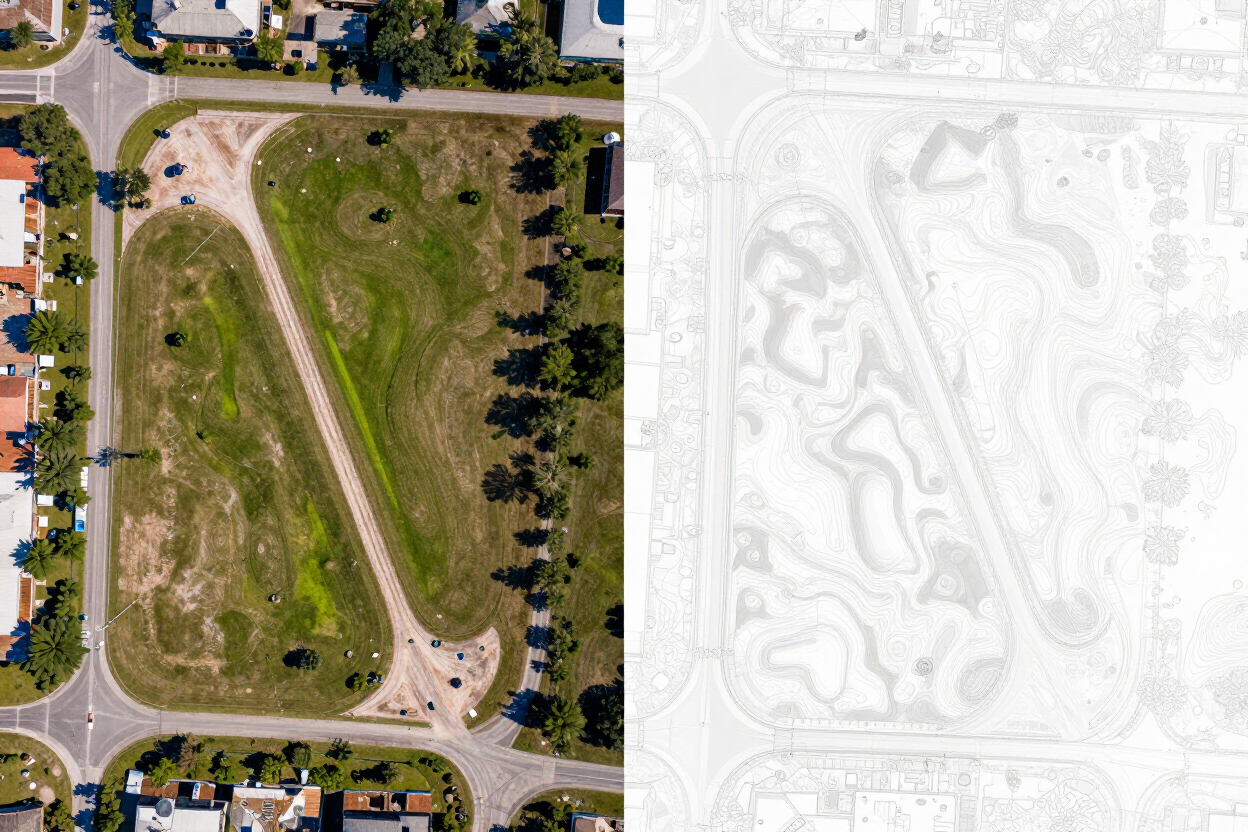
Deliverables include high-resolution orthomosaic aerial imagery, a georeferenced 3D point-cloud model, and a structured set of analysis and reporting tools—all accessible through the FDC Reality platform, with no ongoing licensing or storage fees during the project lifecycle.
*Long-term post-project storage is available upon request.
What a Reality Model Delivers
A complete suite of site-intelligence tools — built into every Reality Model deliverable.
Lot Grade Viewer
Review individual lot grades against design elevations and identify areas requiring adjustment before construction begins.
Timeline & Site-History Viewer
Track site changes over time with a chronological flight-by-flight record — compare any two capture dates side by side.
PDF & CAD Plan Overlays
Overlay approved construction plans, plats, or engineering drawings directly onto the orthomosaic for instant visual verification.
Pad As-Built Reports
Document finished pad elevations against design specifications — supporting quality control and lender or agency reporting.
Dirt Quantity & Cut/Fill Reports
Quantify earthwork volumes across the site or by defined zones — supporting contractor payment, progress tracking, and design validation.
Cross-Section Slicing
Extract precise elevation cross-sections at any alignment across the site model for design review and drainage verification.
Surface Runoff & Drainage Reports
Analyze modeled surface flow paths and drainage patterns using the LiDAR-derived terrain — identify potential issues early.
360° Aerial Panoramas
Capture immersive overhead panoramic views of the site for remote review, stakeholder communication, and project documentation.
Site Walkthroughs
Fly through or navigate the site model in a guided or free-roaming walkthrough experience — shareable with your full team.
Custom Photos & Videos
Request targeted aerial photography, video footage, or documentation captures to meet specific project or reporting needs.
Visibility Through Every Phase
The Reality Model is built to support your project team from the first site visit through final handover — delivering actionable intelligence at every stage.
01
Raw Land
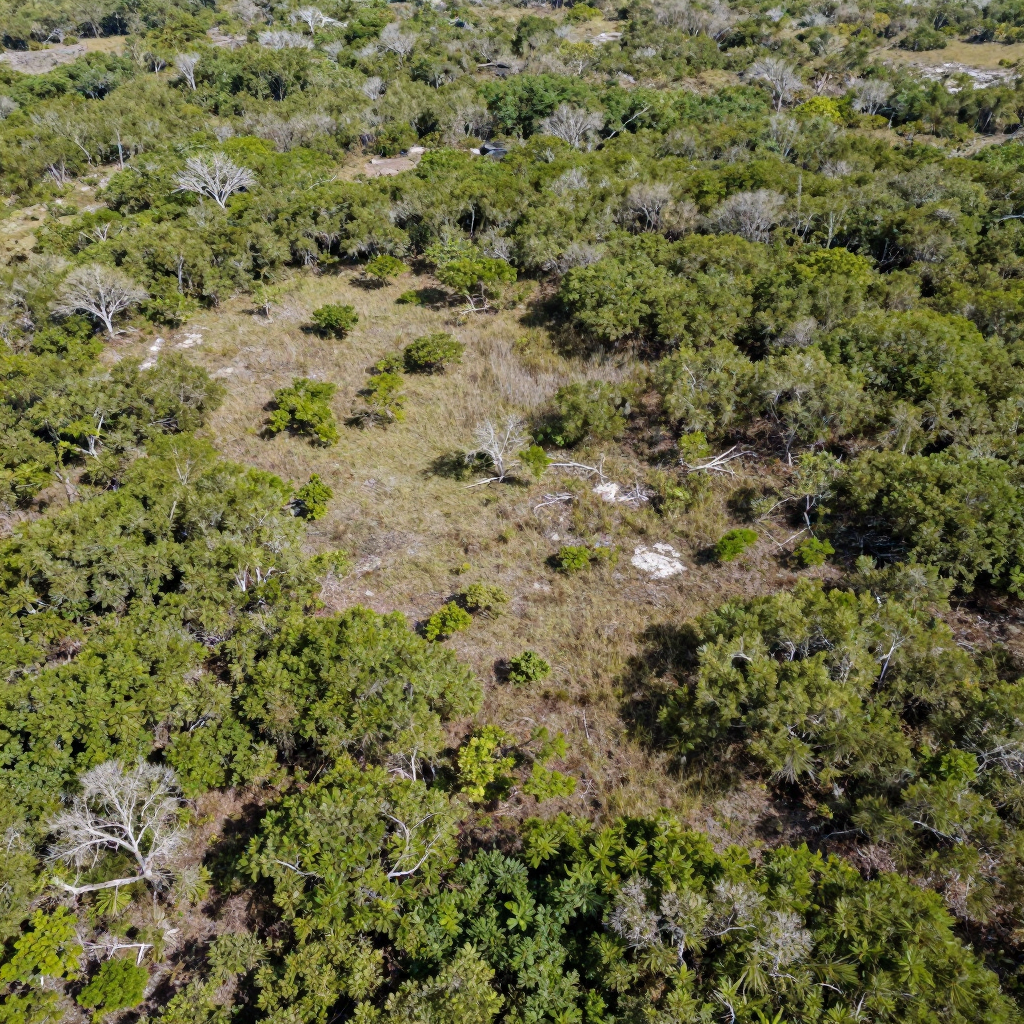
Establish an accurate baseline survey model before any ground disturbance. Document existing vegetation, drainage patterns, and topographic conditions.
02
Planning & Development
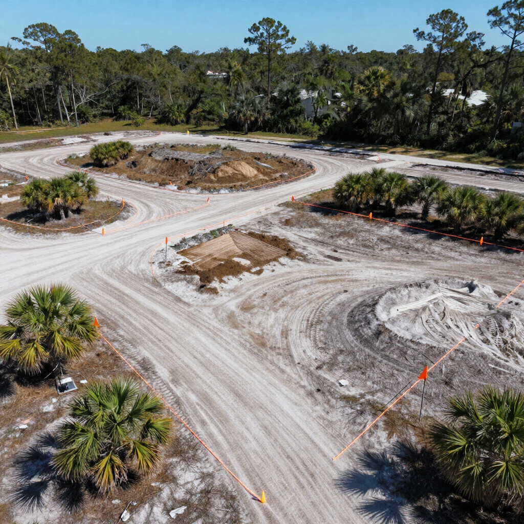
Overlay approved engineering plans onto the existing site model. Identify design conflicts and verify grading assumptions before construction mobilizes.
03
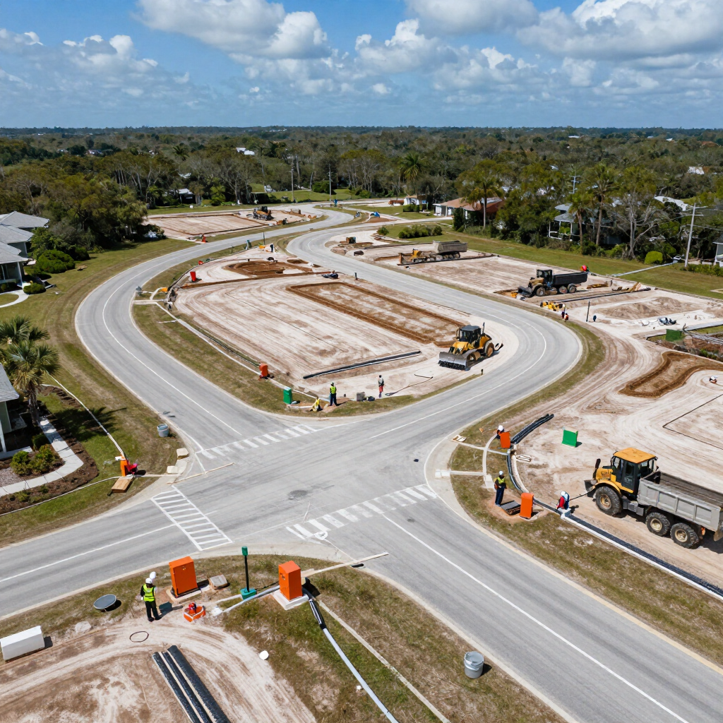
Active Construction
Track earthwork progress, confirm pad elevations, and quantify cut/fill volumes in near real time — reducing costly rework and disputes.
04
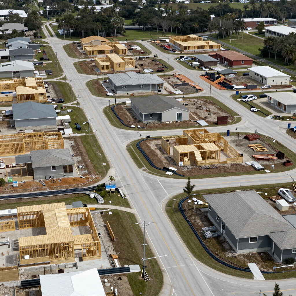
Inspection & Documentation
Generate pad as-built reports, drainage analyses, and documentation packages to support regulatory submissions, lender requirements, and QA reviews.
05
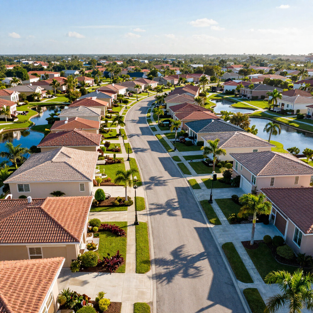
Completion & Handover
Deliver a complete site-history archive and final documentation package — a permanent, accessible record of every phase from raw land to completion.
Who the Reality Model Is Built For
The Reality Model is designed for teams managing multi-phase development projects who need accurate, accessible site data — not a subscription service.
Developers & Home Builders
Managing dozens of lots across multiple phases? The Reality Model gives your team a shared, always-current view of site conditions — without waiting on field crews or manual reports.
Contractors & Construction Teams
Confirm earthwork quantities, document progress, and resolve disputes with survey-grade data captured by licensed professionals — not a consumer drone app.
Municipalities & Government Agencies
Support regulatory review, infrastructure planning, and public documentation with professional-grade aerial site models and deliverables.
Civil Engineers & Surveyors
Integrate LiDAR-derived terrain data, orthomosaic imagery, and CAD overlays directly into your design and QA workflows — grounded to established survey control.
Project Owners & Lenders
Maintain a verified, timestamped record of site progress at every phase — supporting financing draws, insurance requirements, and final closeout documentation.
In-House Professional Expertise vs. Typical Outsourced Capture
Not all reality-capture providers are the same. Understanding what sets FDC Reality apart starts with how the work is done.
| FDC Reality | Typical Outsourced Provider |
|---|---|
| Survey-grade horizontal and vertical site control established by licensed professional surveyors | May lack licensed survey control; accuracy unverified |
| In-house FAA-licensed pilots and professional surveyors on every project | Third-party operators; credentials and insurance may vary |
| Professional review of all data and deliverables before release | Limited or no professional QA; data delivered as-is |
| Customized deliverables built around your project workflow | Standardized outputs; limited customization |
| No monthly licensing or ongoing storage fees | Subscription platforms with recurring costs |
| Direct access to the project team — surveyors, engineers, and pilots | Vendor support queues with no professional oversight |
| 30+ years of Florida surveying and civil engineering context | No industry-specific expertise |
FDC Reality is an extension of Florida Design Consultants, Inc. — a licensed Florida surveying and civil engineering firm with more than 30 years of professional practice.
See a Reality Model Firsthand
The following screenshots and interface views represent the type of deliverable your team will receive — accurate, layered, and built around your project.
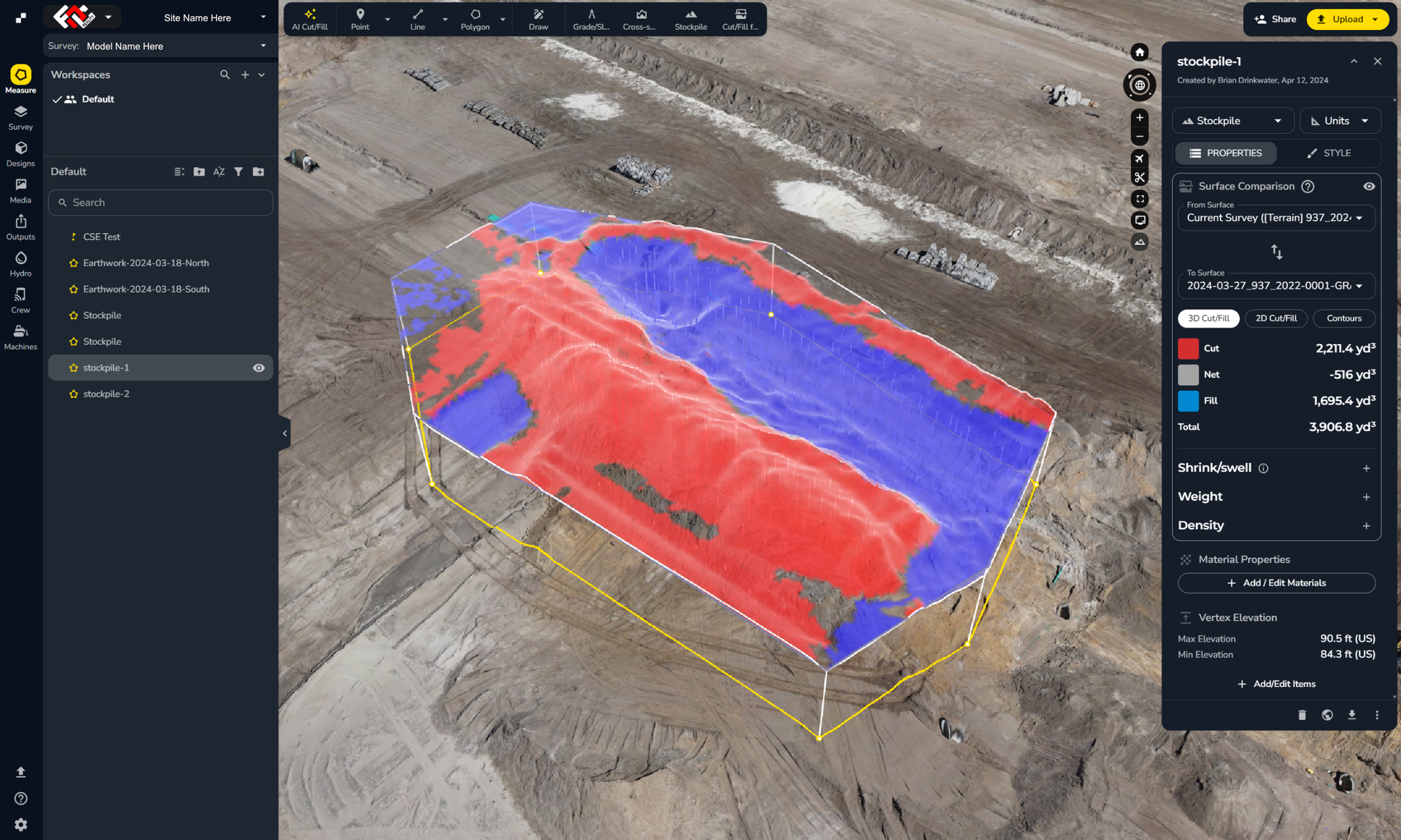
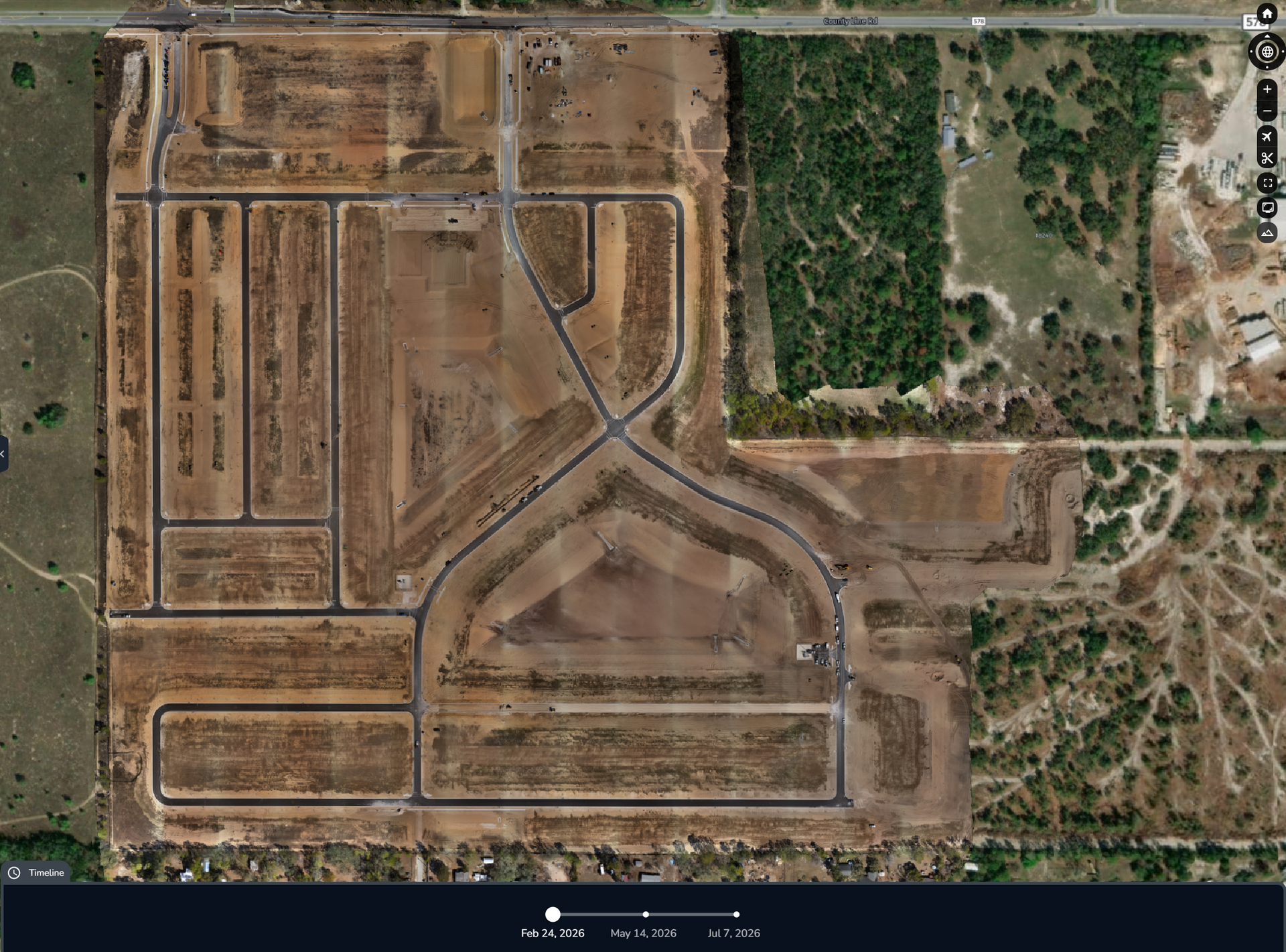
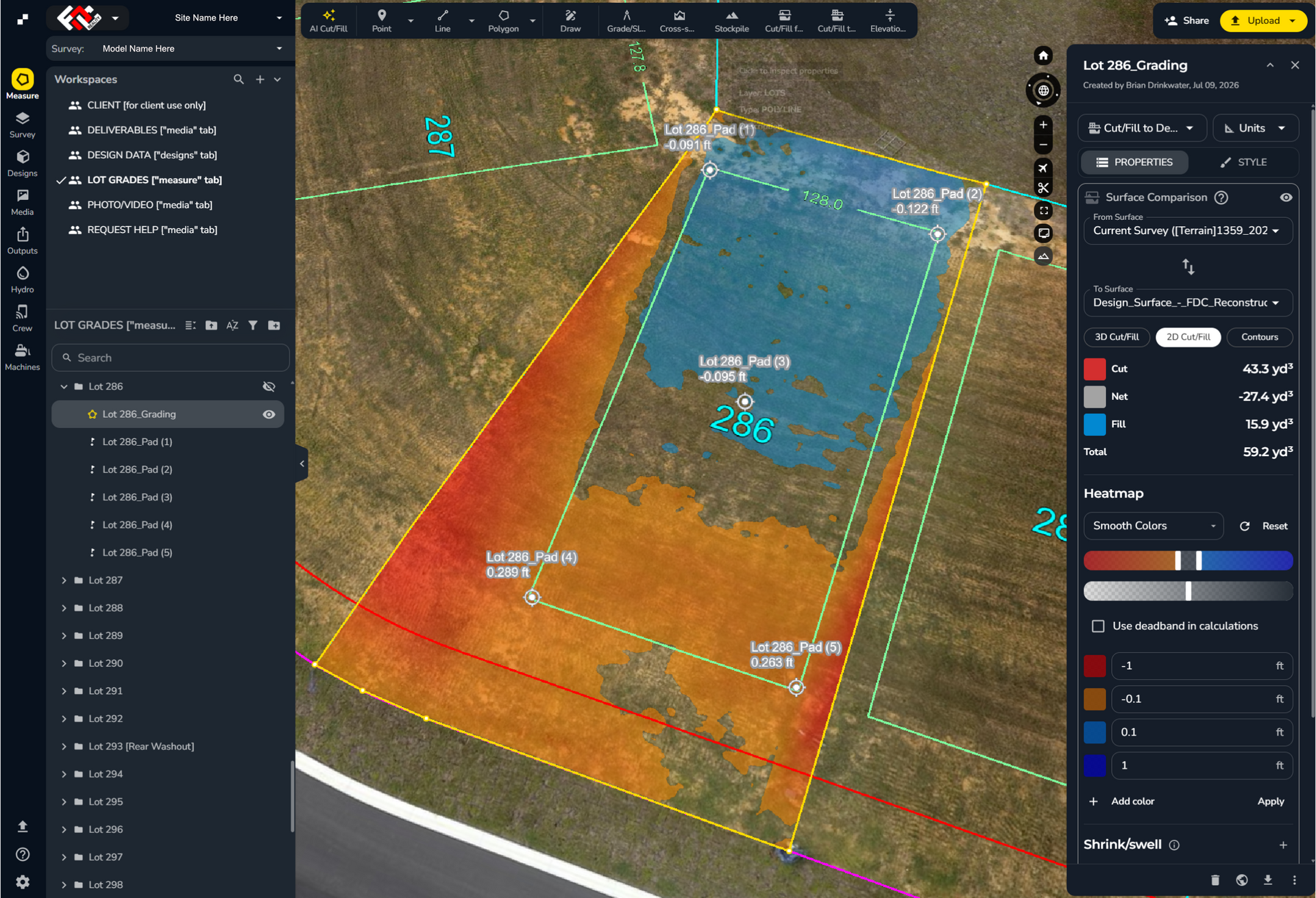
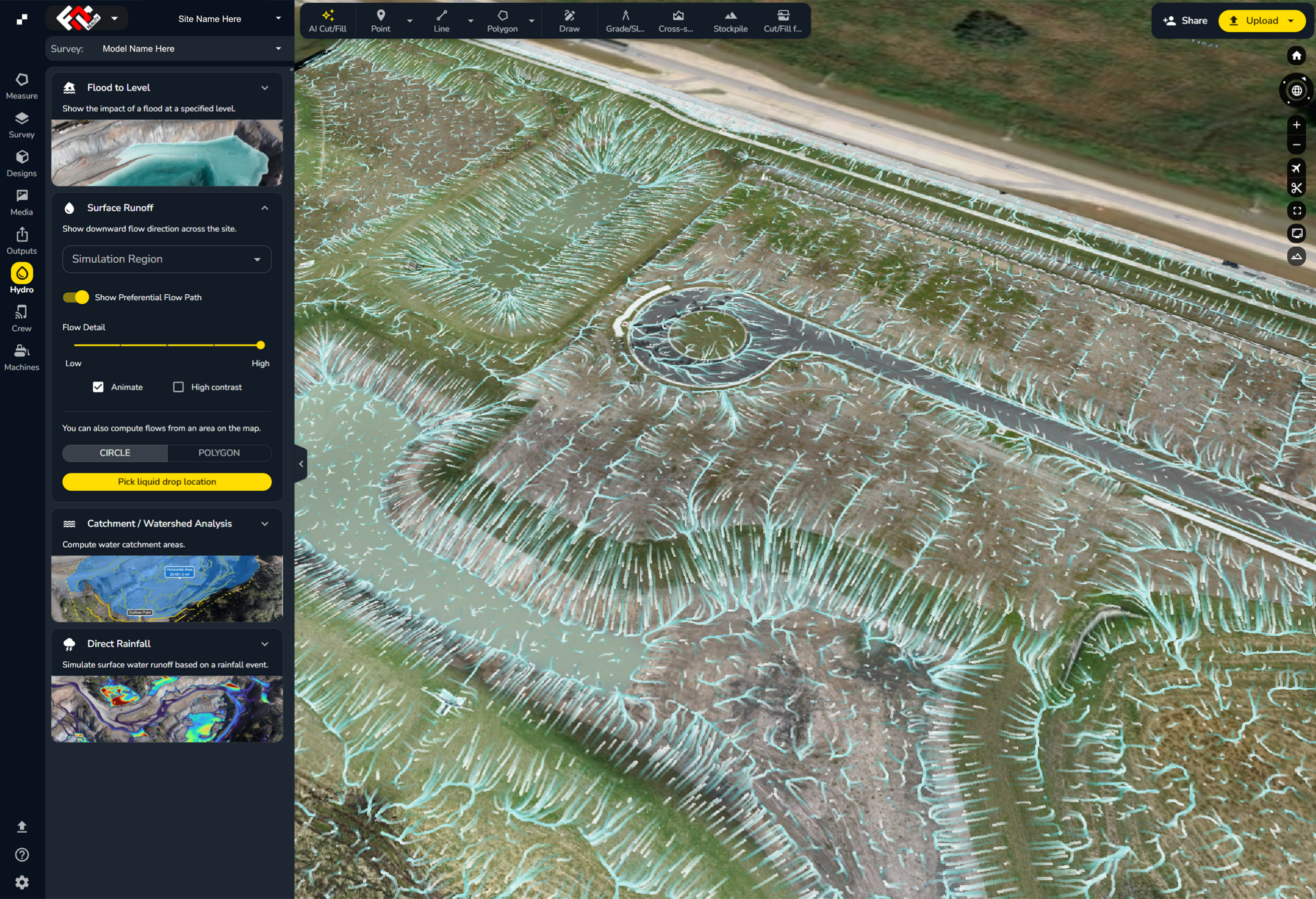
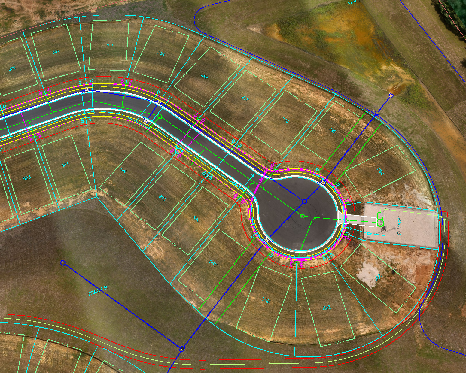
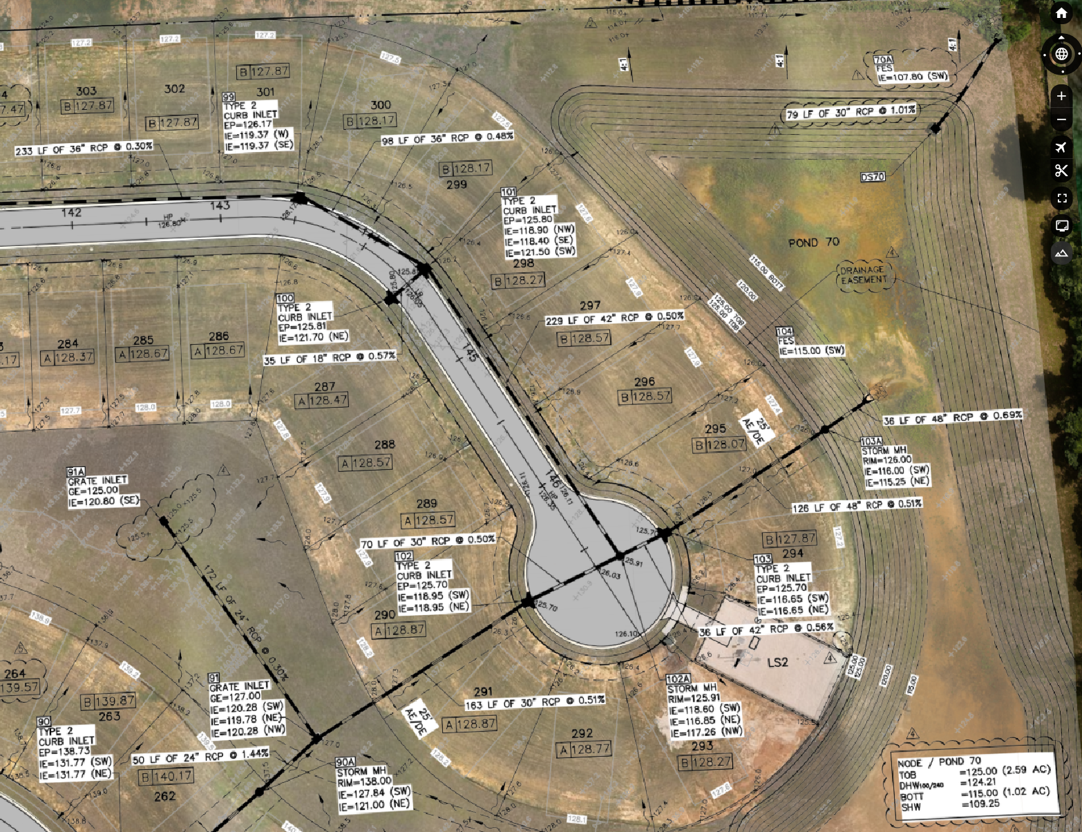
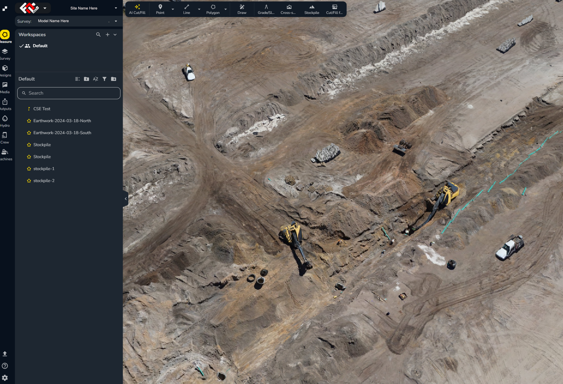
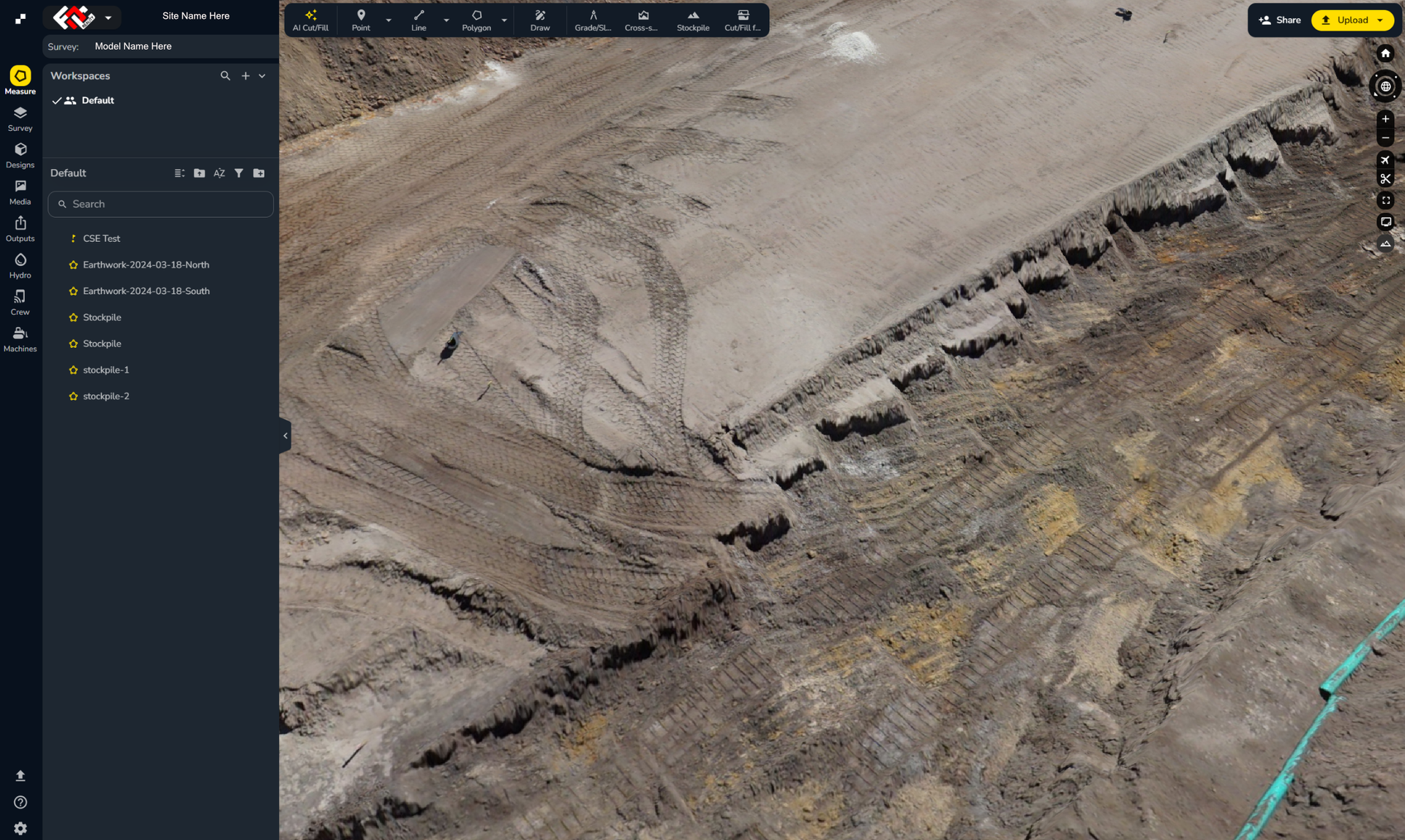
Images shown are representative of FDC Reality deliverable types. Specific project content, branding, and customization will vary.
Video Demonstrations
Reality Model — Frequently Asked Questions
Find answers to common questions about Reality Model accuracy, delivery, updates, file formats, software access, hosting, and professional applications.
How is a Reality Model different from a standard drone survey?
A Reality Model combines high-resolution aerial imagery, LiDAR data, survey control, and interactive analysis tools within one accessible, web-based environment. Unlike a standard drone survey that may provide only imagery or individual data files, a Reality Model can incorporate measurements, plan overlays, site-history comparisons, reports, multimedia, and other project resources to create a more comprehensive source of project information.
How accurate is the Reality Model?
Reality Models are built on the same rigorous horizontal and vertical accuracy standards of all Florida Design Consultants signed and sealed surveys. Actual accuracy depends on the site, equipment, control, and intended application, so contact FDC Reality to discuss your project requirements. Reality Models are not Signable Surveys. If a Signable Survey is required, please refer to our Reality Survey options or contact our parent company Florida Design Consultants, Inc. for a consultation.
How long does it take to receive a completed Reality Model?
Models are delivered in a staged process with the initial model available soon after the day of flight, with photographic, overlay, and report data following close behind. To ensure the highest levels of accuracy, delivery dates depend on the project size, complexity, processing requirements, and requested deliverables.
How often can the site be re-flown and updated?
The site can be re-flown and the Reality Model updated as often as the client requires. Repeat flights can help teams monitor progress, compare changing conditions, and maintain a visual record throughout the project lifecycle.
What file formats and deliverables are included?
Deliverables are customized to the needs of each project. Orthomosaic imagery is typically provided in JPEG format, LiDAR data may be supplied as .las or .laz files, and CAD deliverables are commonly provided as .dwg or .dxf files. Additional formats may be available upon request.
Can we overlay our existing engineering or CAD plans?
Yes. Client-provided engineering, CAD, or PDF plans can be overlaid by the FDC Reality team, allowing proposed designs to be compared with current site conditions. Clients must provide the plans and confirm they are approved for use.
Do we need any special software to access the Reality Model?
No special software is required for standard access. Reality Models, Exhibits, Reports, and Scans are web-based solutions that can be viewed through a compatible browser from virtually anywhere. FDC Reality works with technology partners including Propeller, a leader in drone-data analytics, and Rock Robotic, a specialist in LiDAR and site-scanning technology, to support advanced project capabilities.
Are there ongoing subscription or storage fees?
FDC Reality does not charge storage or licensing fees during the active lifecycle of a project. Long-term hosting and storage are also available and may be subject to a minimal annual fee. Contact the FDC Reality team to discuss the anticipated duration and storage requirements for your project.
Is the Reality Model suitable for regulatory submissions or lender reporting?
Reality Models provide highly accurate and reliable project information, but they are not themselves signed and sealed surveys and may not be appropriate for every regulatory or lender submission. When required, qualifying data can be converted into a signed and sealed survey by FDC Reality’s in-house licensed surveyors and engineers.
Can the Reality Model be used alongside our existing surveying or engineering team?
Yes. Reality Models can complement an existing surveying, engineering, construction, or development team by providing detailed site information, visual documentation, measurements, overlays, and progress data in an accessible format.
Turn Your Project Into an FDC Reality.
Let's discuss the Reality Model capture, analysis, and reporting your project team needs.
FDC Reality is an extension of Florida Design Consultants, Inc. — serving clients across Florida.